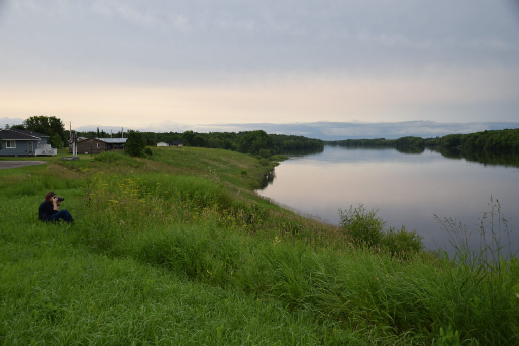
Rainy River

The Rainy River is so central to Du Vernet’s diary that it almost becomes a character in itself. The River connects the towns and villages Du Vernet passed through, and Du Vernet never tired of describing its beauty. The water could be calm and mirror like in one moment, and then swept up by “tremendous storms of wind and rain” in the next. The river stretches for about 137 kilometers and forms part of what is now the US-Canadian border, acting as the dividing line between northwestern Ontario and Minnesota. It flows westward, from the western end of Rainy Lake to the southern end of the Lake of the Woods.
All Roads Lead to…
The Rainy River is an integral link in northern North America’s system of waterways, connecting either directly or through short portages to many of the continent’s major water systems. To the east, from Rainy Lake, it connects to Lake Superior and the Great Lakes and then to the St. Lawrence River system. To the west, the Rainy River connects to the Lake of the Woods, and then to the Winnipeg River and Saskatchewan River. And to the north it connects to the Albany and Nelson Rivers, while the Big Fork River, a tributary of the Rainy River, connects to the Mississippi River in the south.
The History of People Along the Rainy River
Because of the Rainy River’s links with North America’s many waterways, and it’s abundant stocks of sturgeon, it was an attractive site for both Indigenous and European peoples. Indigenous peoples lived along the river’s banks for millennia at the Long Sault site. Europeans used the river to transport people and goods during the fur trade and to further explore the interior of Western Canada.
By the late seventeenth century the Ojibwe were the most prominent Indigenous peoples along the Rainy River. In 1873 the government, under Treaty 3, relocated the Rainy River Ojibwe onto seven reserves: Hungry Hall 1 and 2, Long Sault 1 & 2, Manitou Rapids 1 &2, and Little Forks. In 1914, all seven reserves were amalgamated into one single reserve at Manitou Rapids.
The Rainy River became a popular site for sport fishers and a source of hydroelectricity for the town of Fort Frances. For much of the twentieth century, the pulp and paper industry dominated the Rainy River economy, especially around the towns of Fort Frances and International Falls, on the American side of the river. The waste from these mills had serious environmental consequences for the health of the river. In recent years, however, this industry has seen a marked decline and several large mills have closed.
Today, Rainy River First Nations has embarked on a long term process of buying back their land. In 2005, the Rainy River First Nations and the Canadian government agreed to a $71 million land claim settlement that identified land for future reserve creation. Following a court order in February 2017, the governments of Ontario and Canada, together with the Rainy River First Nations, announced the creation of some 6,000 additional hectares of reserve land. Although the river is no longer the major travel route it once was, the Rainy River is still an important character in the lives of the people and animals who call it home.
Sources
Animikii, Robert Horton. “A Seventh Fire Spark Preparing the Seventh Generation: What are the Education Related Needs and Concerns of Students from Rainy River First Nations?” Master’s Diss., Lakehead University, 2011.
“Canada, Ontario and Rainy River First Nations Announce New Reserve Creation.” Turtle Island News, May 23 2017. Accessed July 9, 2017.
Williams, David Arthurs. “The Long Sault Site: Cultural Dynamics in the Rainy River Valley of Northwestern Ontario.” Master of Arts Diss., University of Manitoba, 1982.