• Skip to primary navigation
  • Skip to main content
  • Skip to primary sidebar

Kiinawin Kawindomowin — Story Nations

The diary of a missionary on Ojibwe land

  • The Project
    • About the Project
    • The Book
      • About The Story of Radio Mind
    • Using the Website
    • About Us
    • Contact Us
  • The Diary
    • About the Diary
    • Diary Episodes — Read & Listen
    • Manuscript & Transcription
    • Editing Story Nations
    • Glossary and Index
    • Further Reading
  • Stories from Manidoo Ziibi
    • About Stories from Manidoo Ziibi
    • Watch & Listen
    • Map Gallery
    • Student Essays
    • Art of Manidoo Ziibi
  • Visit Kay-Nah-Chi-Wah-Nung
    • About the Historical Centre

Episode 19: Into the Lake of the Woods

https://storynations.utoronto.ca/wp-content/uploads/2017/11/19_Into-The-Lake-of-the-Woods.mp3

Click on the “play” button to hear the diary episode read aloud, and click on the green tab 1 to learn more about a word or phrase.
Find Du Vernet on a map.

Black-and-white photograph, view of Rat Portage and water, c. 1900.
View of Rat Portage and water, ca. 1900. Courtesy of Société Historique de Saint-Boniface.

Friday, July 22:

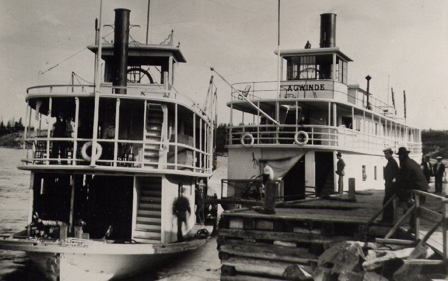
Left by the Keenora 2  at 8 A.M. The morning was dull but the clouds added to the river scene; one spot especially where the light green crop of grain, with a little cottage nearby, was perfectly reflected in the still water, lives in my memory. At about two o’clock we reached the upper end of the Indian Reserve of Hungry Hall 3 . There we saw Joseph McLeod 4 , the Christian 5  Indian 6 , on the wharf, and he smiled, and saluted me with his hand.

After crossing the big Traverse 7 we entered the Islands of the Lake of the Woods 8 . This lake well deserves its name. The islands are covered with evergreen trees 9  chiefly of young growth, as the larger trees have been cut or burnt. There are some pine trees with their tall tops, bent by wintry blasts. Poplar abounds and the white stems of these trees add to the effect that it can truly be said of the islands they are “with verdure clad.” 10

Itaska and Agwinde, two steamers that operated on Rainy River and Lake of the Woods, 1890. Courtesy of the Virtual Reference Library.

There are 18,000 of them, of all sizes, most of them fairly round in shape. In contrast with the thousand islands of the St. Lawrence 11 , what struck me most was the breadth and softness of the scene here. In every direction vistas would open up stretching away for 5 or 10 miles. As the steamer 12 sailed on, the effect could be compared with nothing else than that of a Kaleidoscope: islands would change their relative positions and a new combination would take place. Here and there rocky cliffs could be seen, their crest barely covered with water.

About 14 miles from Rat Portage 13 , the scenery became grander, when the steamer passed between islands closer together, with high bluffs. One was called Crow Rock, where a cross seemed to be formed and the Channel turned at a right angle, it was very fine.

As we approached the gap, the view from the captain’s bridge, where I had been invited, could scarcely be surpassed for exquisite beauty: it was nearly 8 o’clock and the setting sun was gilding the clouds. The shadows from the well-wooded shores began to deepen across the path of the steamer and the water was a perfect mirror. As we entered the gap it seemed as though we were passing through a succession of little miniature lakes, each one closing in upon us, the light of the setting sun forming the central throne. As we passed this scene, vestibule after vestibule, we went through the Devil’s Gap 14 . On the east side there is a large rock like a skull on which someone has painted red eyes, lips, and a black mustache and goatee: very grotesque. But Rat Portage looked very beautiful in the evening light, and we arrived about 8:20 p.m.

Black-and-white photograph of a parade on Main Street in Rat Portage.
Jubilee Parade passing down Main Street in Rat Portage, 1897. Courtesy of the Virtual Reference Library.

« EPISODE 18: MR. JOHNSTON’S STORY OF TOM OVERCOME
EPISODE 20: MOVING FURTHER WEST »

« « RETURN TO DIARY OVERVIEW
Previous Post: « Episode 18: Mr. Johnston’s Story of Tom Overcome
Next Post: Sweating Tent »

Primary Sidebar

Search Story Nations

Generic selectors
Exact matches only
Search in title
Search in content
Post Type Selectors
Filter by Categories
articles
episodes
essays
Maps
other

  1. X
    green tab
  2. X
    Keenora

    The S.S. Keenora was a steamer built in 1897 to carry passengers and cargo up and down the Lake of the Woods and Rainy River, from Rat Portage to Little Forks. Read more.

    The Keenora at Fort Frances in 1899. Courtesy of Library and Archives Canada.

  3. X
    Hungry Hall

    Hungry Hall No. 1 and 2 were two Ojibwe Indian Reserves situated on the Rainy River’s western mouth at the Lake of the Woods. Like Long Sault, Manitou Rapids, and Little Forks, the Hungry Hall reserves came into existence in 1873 under Treaty 3. In 1914 and 1915 the government closed Hungry Hall along with the other Rainy River Indian Reserves, forcibly moving people from their homes to Manitou Rapids, where the government amalgamated the Rainy River Reserves. Read more.

    Plan of Indian reserves, townships No. 2 & No. 3, ranges 21 & 22 east of Principal Meridian. Courtesy of Library and Archives Canada

  4. X
    Joseph McLeod

    Du Vernet speaks of Joseph McLeod as a “Christian Indian,” but in other sources he is known as Wabanaquebe. Read more.

    A sketch of Hungry Hall in 1872 by E. H. Griffiths. Courtesy of Library and Archives Canada.

  5. X
    Christian

    When Du Vernet writes “Christian”, he usually means an Anglican, or a person who was baptized in the Church of England. Read more.

  6. X
    Indian

    Du Vernet constantly refers to the Ojibwe peoples he encounters as “Indians” – his use of the word reflects the language and concepts of his day. Though the category of “Indian” was a legal designation in Canada because of the “Indian Act,” as a name for Indigenous people it originated in a profound error. As the story goes, when Christopher Columbus arrived in the Americas in 1492 he believed he had arrived in India – and therefore called the peoples he encountered Indians, ignoring their diverse languages, spiritual traditions, and forms of governance. Read more.

    A section of the 1876 Indian Act. Courtesy of Early Canada Online.

  7. X
    big Traverse

    The southern half of the Lake of the Woods, often called the Big Traverse Bay.

  8. X
    Lake of the Woods

    The Lake of the Woods, dotted with over 14,000 islands, has long been a spiritually powerful place of Anishinaabe life. Called Pikwedina Sagainan in Anishinaabemowin, the lake covers an area of 36,000 miles and borders on what is now northwestern Ontario, Manitoba, and Minnesota. In 1898, Du Vernet traveled through the Lake of the Woods twice, once on his way to the Rainy River, which the lake connects to in the south, and once on his way back to Rat Portage. Read more.

    Wigwams on an island in Lake of the Woods in 1872. Courtesy of Library and Archives Canada.

  9. X
    evergreen trees

    The Lake of the Woods islands are rocky and densely treed, and Du Vernet comments often on their beauty.

  10. X
    “with verdure clad.”

    Du Vernet may have been quoting from Hayden’s oratorio The Creation, which describes how “With verdure clad the fields appear delightful to the ravish’d sense” soon after God made the Earth. Du Vernet often used Christian and European concepts to describe the traditional Indigenous landscapes he encountered.

  11. X
    thousand islands of the St. Lawrence

    The Thousands Islands is an archipelago of 1,864 where the St. Lawrence River joins Lake Ontario.

  12. X
    steamer

    A steam powered boat used by Europeans to travel the Lake of the Woods and the Rainy River in the late nineteenth century. Read more.

  13. X
    Rat Portage

    Rat Portage was a town on the northerly tip of Lake-of-the-Woods. Rat Portage began as a fur trade post in the early nineteenth century and was connected to the railway in the 1870s. In 1902, Rat Portage was amalgamated into the city of Kenora. The Obashkaandagaang and Wauzhushk Onigum First Nation Reserves are neighbours to Kenora today. Read more.

  14. X
    Devil’s Gap

    It is not clear who painted this figure, which can still be seen today.