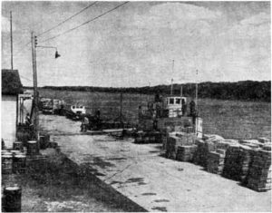
Selkirk
After his travels along the Rainy River, Du Vernet found his way to East and West Selkirk, two towns just north of Winnipeg, separated by the Red River. In the early nineteenth century, the area was home to a community of Saulteaux, Ojibwe, Swampy Cree, and Métis peoples known to Euro-Canadians simply as the “Indian Reserve” and later, as St. Peter’s. Treaty 1, signed in 1871 between the Crown and the region’s Indigenous peoples, recognized the land as Saulteaux and Cree territory. Yet in 1875, the CPR planned to build a bridge over the Red River in the area that was Selkirk. Speculators, entrepreneurs and white settlers, anticipating the railroad’s course, bought up the surrounding land and began an illegal settlement on what was then the southeastern corner of St. Peter’s Parish. This illegal settlement grew on both sides of the Red River’s banks and became the town of East and West Selkirk. For more on the history of St. Peter’s Reserve, see St. Peter’s Reserve Article.
Yet, as Du Vernet remarked and the residents of Selkirk never forgot, the railroad was built through Winnipeg instead, leaving only a branch line for Selkirk. Nonetheless, in 1882 West Selkirk was large enough to incorporate as a town and East Selkirk did the same the following year. Even after incorporating, both towns remained separated by the Red River. Du Vernet had to walk a great distance and cross the river twice to travel from East to West Selkirk. At the time, a ferry was mostly used to transport people and livestock across the River. A bridge was finally built in 1936.
Sources
Burrows, Paul P. “‘As She Shall Deem Just:’ Treaty 1 and the Ethnic Cleansing of the St. Peter’s Reserve, 1871-1934.” Masters Diss., University of Manitoba, 2009.
